
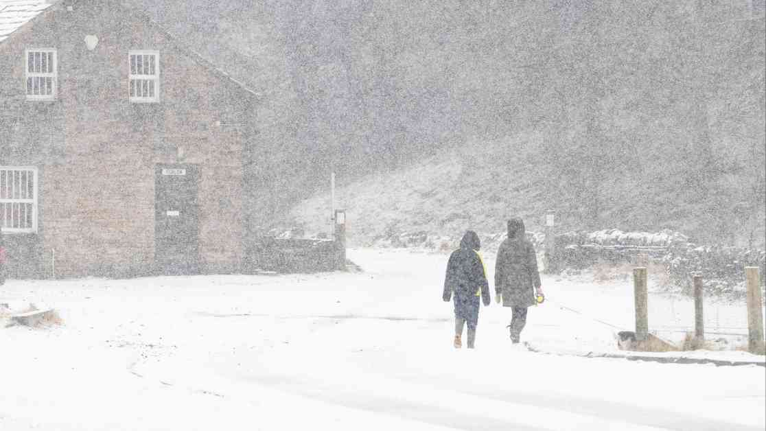
The recent weather forecast from the Met Office has sent shivers down the spine of many with a warning of plunging temperatures and snow in the near future. The bone-chilling -8.6C recorded over the weekend has set the stage for what could be a wintry blast across the UK. The agency has raised concerns about a potential return of the Beast from the East, sparking fears of snow and ice warnings. As frost blankets Richmond Park in London and snowfall graces Nenthead in Cumbria, the cold health alerts issued by the UK Health Security Agency (UKHSA) only add to the growing sense of unease.
Meteorologist Jonathan Vautrey sheds light on the forecast, painting a picture of snow showers expected to grace parts of the north and east today. He describes how high pressure systems from Scandinavia are ushering in an icy easterly wind, laden with moisture and cloud cover, creating a cold, damp, and gloomy atmosphere at the beginning of the week. According to Vautrey, temperatures are anticipated to hover around 6 to 6 degrees Celsius for most regions, further plummeting to near freezing when coupled with the biting easterly wind, making it feel even colder outside. Eastern coastal districts are set to experience the brunt of the chill, with cloud cover and showers persisting into the night.
As the day progresses and the evening sets in, the Met Office’s five-day forecast paints a picture of rain, sleet, and hill snow across central and eastern parts of the country. Forecasters anticipate patchy frost overnight in certain regions, with a likelihood of longer spells of rain in the southeast come tomorrow. This dreary weather pattern is expected to persist through Tuesday, characterized by a sense of grey, dull gloominess that could dampen spirits.
Insights from Meteorologists
Meteorologist Marco Petagna chimes in, highlighting the potential for temperatures to dip as low as minus 5 to minus 6 degrees Celsius in regions with clearer skies. However, the presence of wind and cloud cover may prevent widespread frosts, sparing many regions from the icy grip of winter. While the specter of frost looms large in some areas, the rest of the UK is expected to narrowly escape the freezing temperatures, thanks to the moderating influence of wind and cloud.
In a reassuring post on social media, the Met Office seeks to allay fears by comparing the current weather pattern to the infamous Beast from the East event of 2018, assuring the public that conditions are not expected to be as severe. Their forecast points to a persistent area of high pressure over Scandinavia in the coming weeks, ushering in a cold, east or southeasterly airflow across the UK. The recent dip in temperatures to -8.6C in Altnaharra and Kinbrace in north Scotland serves as a stark reminder of the winter chill that lies ahead.
Health Alerts and Forecast
The UKHSA has issued four yellow cold health alerts for several regions, indicating an increased risk to vulnerable groups who may require additional healthcare services. The five-day weather forecast paints a grim picture of cloudy skies, rain, and hill snow, particularly in the north and east. Tuesday is expected to bring more of the same, with cold, grey conditions persisting across the country and a smattering of rain and hill snow in the forecast.
Looking ahead to the middle of the week, expect more of the same with cloudy conditions, occasional patchy rain and hill snow, and a growing risk of heavier rain in the west by Friday. The easterly breeze is set to continue, ensuring that the cold spell remains firmly entrenched. As the nation braces itself for the impending wintry weather, it’s essential to stay updated on the latest forecasts and heed any warnings issued by the Met Office to stay safe and prepared.


